Tianyi Sensor IOT Technology Co., Ltd
Sales Manager:Ms. Emily Wang
Cel,Whatsapp,Wechat:+86 15898932201
Email:info@fengtutec.com
Add:No. 155 Optoelectronic Industry Accelerator, Gaoxin District, Weifang, Shandong, China


Sales Manager:Ms. Emily Wang
Cel,Whatsapp,Wechat:+86 15898932201
Email:info@fengtutec.com
Add:No. 155 Optoelectronic Industry Accelerator, Gaoxin District, Weifang, Shandong, China
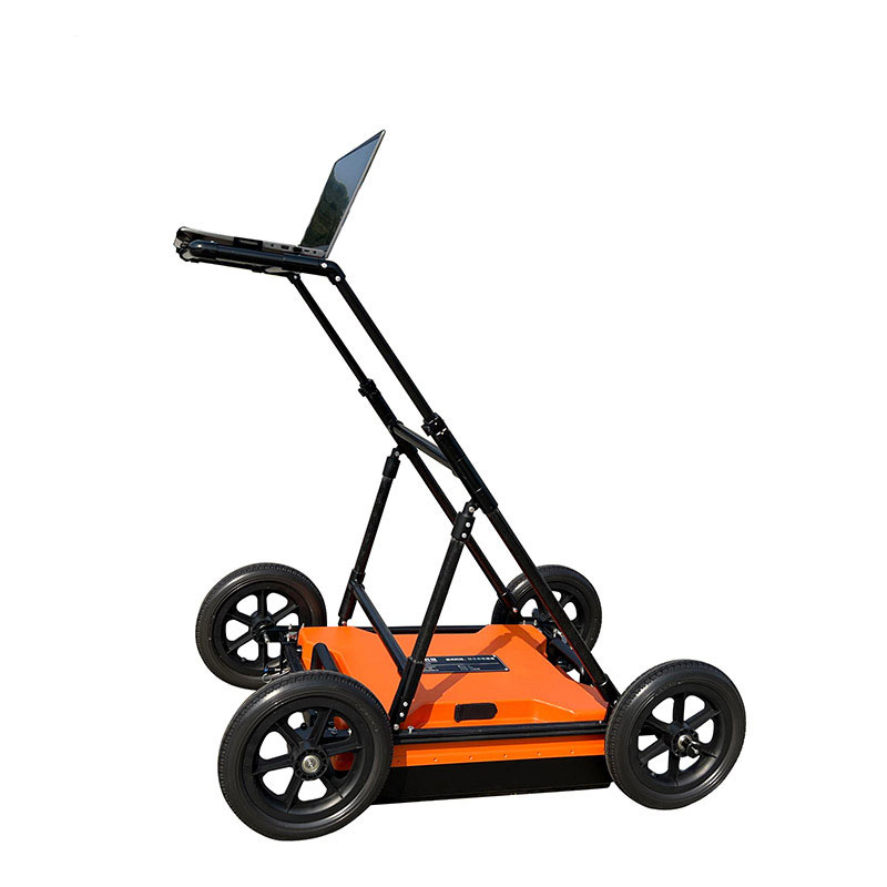
Model:FT-DZLD1
Brand:tianyi
1.Uses of Ground Penetrating Radar
Ground Penetrating Radar is a high-resolution geophysical method for detecting changes in subsurface objects, materials, voids and cracks.It is suitable for geological disaster assessment and governance, engineering exploration and design related projects; engineering survey, municipal pipelines, road and bridges, tunnel inspection and other fields, and is used to detect or identify metal or non-metal target information within a certain underground depth.The specific classification is as follows:
Geological disaster assessment: used to identify geological information such as holes, detachment, and broken zones in underground space;
Engineering survey: used to find information on underground abnormalities such as karst, collapse, crushing belts, etc.in the engineering area;
Municipal pipeline: used to find out the distribution of underground metal or non-metal pipelines during urban construction;
Road and bridge: used to investigate poor geological bodies during the identification of roads or bridge location selection;
Tunnel detection: used for tunnel advance forecasting, detection of tunnel construction quality, etc.;
2.Ground Penetrating Radar product features
This product adopts the industry-leading integrated design of host and antenna, with small size, light weight and low power consumption;
The host and computer are wirelessly connected, which is convenient to operate;
Realize real-time data collection and display;
The software interface is simple, easy to operate and quick to get started;
Multi-band antennas are optional and have a wide range of applications;
The analysis software is simple to operate and the results are accurate to interpret;
High detection accuracy and accurate positioning;
Built-in ultra-large capacity battery, long battery life;
Ergonomic structural design, simple, durable and easy to operate, is very suitable for outdoor mobile working environments.
3.Ground Penetrating Radar complies with the specifications
"Geophysical Exploration Procedures for Hydropower and Water Conservancy Engineering DL/T 5010-2005"
"Petrophy exploration procedures for water conservancy and hydropower engineering SL326-2005"
"Technical Regulations for Geophysical Exploration of Electric Power Engineering DL/T 5159-2012"
"Underwater Engineering Geophysical Exploration Procedure DB34/T 2209-2014"
"Highway cross-section flaw detection and structural layer thickness geological radar JT/T 940-2014"
"City Engineering Geophysical Detection Standard CJJ/T 7-2017"
"Technical Regulations on Urban Underground Pipeline Detection CJJ 61-2017"
"Radar Method Inspection Construction Engineering Quality Technical Regulations DGJ 32-TJ79-2009"
"Technical Regulations on Advance Geological Forecasting of Railway Tunnels Q/CR 9217-2015"
"Technical Standard for Comprehensive Detection and Risk Assessment of Urban Underground Diseases"
"Highway Engineering Geophysical Exploration Procedure JTGT 3222—2020"
4.Ground Penetrating Radar performance parameters
| Host | Antenna type | Single shielded antenna |
| Antenna frequency | 200MHz | |
| Sampling frequency | 0.2-100GHz adjustable | |
| Time window range | 1ns~20000ns, continuously adjustable | |
| Number of sampling points | 32~32767 sample points/scan, optional | |
| Scan rate | 200 lines/second | |
| A/D conversion | 18bit | |
| Continuous working hours | ≥8 hours | |
| Power consumption of the whole machine | <16 W | |
| Signal-to-noise ratio | Better than 120dB | |
| Collection speed | > 60 km/h @ 5 cm Horizontal sampling spacing (channel spacing) | |
| Minimum sampling interval | <10ps | |
| Measurement method | Three measurement methods: point-by-point measurement, distance-trigger measurement, and continuous measurement | |
| Display method | Pseudo-color diagram, stacked waveform or grayscale diagram | |
| Operating temperature | -30℃~+70℃ | |
| Operating voltage | 10-15V DC | |
| Wireless data transmission distance | More than 50 m | |
| Wired communication | Ethernet, 100Mbps | |
| weight | <8 KG |
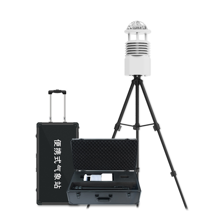
A weather phenomenon sensor is an optical measuring instrument that uses the forward scattering principle. It emits an infrared pulse beam into the atmosphere and receives the scattering signals from aerosol particles, calculating the extinction coefficient to determine the visibility value. T...
The Air Quality Monitoring Station is a miniaturized product dedicated to real - time online monitoring of the atmospheric environment. It has the capability of simultaneous multi - parameter monitoring, which can accurately measure the concentrations of various pollutants in the atmosphere, such as...
Odor online monitor is a professional instrument that utilizes sensor array technology to perform real-time, continuous automatic monitoring of complex odor concentrations and characteristic malodorous gases in the environment. It can quantify and output dimensionless odor concentration OU values an...
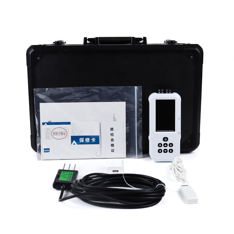
The Handheld Weather Station FT - SQ6+ takes "full - element monitoring + precise positioning + intelligent interconnection" as its core. It gives consideration to portability and professional performance. It not only meets the needs of mobile scenarios such as outdoor operations and emerg...


 Get a Free Quote
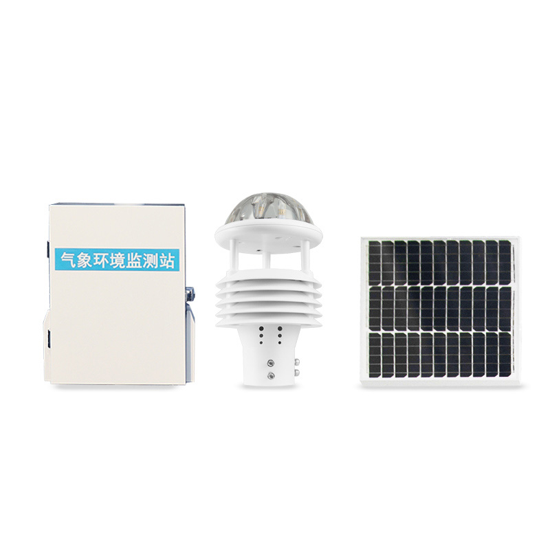
 Skype
Skype
 whatsapp
 mail
mail