Tianyi Sensor IOT Technology Co., Ltd
Sales Manager:Ms. Emily Wang
Cel,Whatsapp,Wechat:+86 15898932201
Email:info@fengtutec.com
Add:No. 155 Optoelectronic Industry Accelerator, Gaoxin District, Weifang, Shandong, China


Sales Manager:Ms. Emily Wang
Cel,Whatsapp,Wechat:+86 15898932201
Email:info@fengtutec.com
Add:No. 155 Optoelectronic Industry Accelerator, Gaoxin District, Weifang, Shandong, China
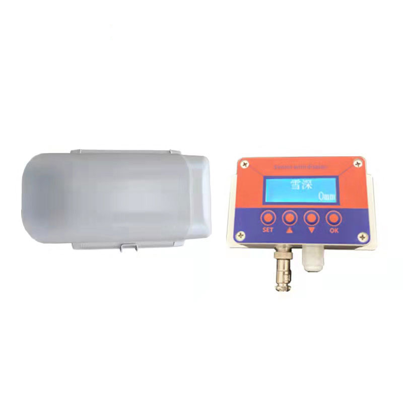
Model:FT-JX2
Brand:tianyi
1.Overview of Snow Depth Sensor
Snow Depth Sensor uses visible laser measurement technology with millimeter-level accuracy for precise, continuous and non-contact recording of snow depth.Water is the foundation of the existence of various creatures on the earth.The changes and movement of water have created our world today.Snowfall is an important part of the water cycle.Snowfall has a certain impact on the balanced development of the ecological environment and people's lives and production.
Automatic snow depth monitoring station is a professional equipment for real-time monitoring of snowfall information based on years of experience in manufacturing meteorological and environmental instruments.The equipment uses laser recognition and measurement technology to overcome ultrasonic waves, electromagnetic waves, weight and other types.The sensor cannot recognize the disadvantages of snow, thus achieving extremely high detection accuracy.By monitoring the distance at the location, the thickness of the snow is obtained and the snowfall per unit time is analyzed.This device can be an independent automatic snow depth monitoring alarm system, or it can be networked to form a diversified network monitoring.
Application scope: Widely used in many fields such as meteorological stations, port terminal safety monitoring, road traffic safety monitoring, aviation monitoring, building safety monitoring, agricultural production monitoring, hydrology and water conservancy.
2.Snow Depth Sensor laser ranging principle
The snow depth sensor uses the principle of a phase laser rangefinder to measure the depth of snow.The phase is the frequency of the radio band.The laser rangefinder is used to modulate the laser beam amplitude and measure the phase delay generated by the modulated light round-trip measurement line once, and then according to The wavelength of the modulated light is converted to the distance represented by this phase delay.That is, the time required for light to pass through the round-trip measurement line is determined by indirect method, thereby solving the depth of snow.
3.Snow Depth Sensor Technical Parameters
| powered by | DC12-15V | |
| Measurement range | 0.05~5m | |
| Measurement accuracy (standard deviation) | ±1.0mm | |
| Signal output | RS485 | |
| Distance unit | m | |
| Laser Type | 620~690nm | |
| Laser grade | Level II, <1mW | |
| Spot diameter at distance m | 6mm@10m, 30mm@50m | |
| Single measurement time | 0.05~1s | |
| Protection level | IP65 | |
| Operating temperature | -40~+50℃ | |
| Storage temperature | -20~+80℃ | |
| weight | ||
| Dimensions (Length × Width × Height) | ||
| Implementation standards | GB/T 14267-2009 | |
| Power consumption | standard | 0.9W |
| heating | 14W | |
| Heating method | Automatic temperature control | |
Remark:
For different measurement targets and measurement environments, due to the excessive intensity of the ambient light, the ambient temperature is too high or too low, the target reflection is too weak or too strong, or the target surface is rough and uneven, the measurement range may be shortened or the measurement results may be caused.Large error.
How it works:
Measurement method:
After first installing or moving the installation position, you need to adjust the zero.Press "SET" for 5 seconds to complete the zeroing.
The working principle of the sensor: data is collected once in 10 minutes if there is snow (snow depth is greater than 10mm) and data is collected once in 30 minutes if there is snow.
Intra-cavity heating time: When the temperature in the cavity is lower than 0 degrees, turn on the heating mode and heat it for 5 minutes each time.
Meteorological monitoring equipment includes six-parameter automatic weather stations, precipitation sensors, radiation observation stations, and unmanned aerial vehicle (UAV) systems, used to monitor meteorological elements such as temperature, humidity, wind speed and direction, rainfall, at...
Ports serve as critical hubs connecting the ocean and land, with numerous vessels entering/exiting and cargo being loaded/unloaded daily. However, due to their unique geographic locations, ports face complex and variable meteorological conditions. Among these, wind speed and direction significantly...
The traditional meteorological monitoring stations have limited distribution, making it difficult to comprehensively and real-timely grasp the complex and changeable meteorological conditions. However, combining drones with meteorological instruments has unexpectedly become a solution to make up for...
The water and rainwater detection equipment, namely the Water Level Monitoring System, can efficiently and accurately obtain data such as water level, flow rate, and rainfall.The Water Level Monitoring System is a fully automatic hydrological online monitoring system based on microwave technology. I...


 Get a Free Quote
 Skype
Skype
 whatsapp
 mail
mail