Tianyi Sensor IOT Technology Co., Ltd
Sales Manager:Ms. Emily Wang
Cel,Whatsapp,Wechat:+86 15898932201
Email:info@fengtutec.com
Add:No. 155 Optoelectronic Industry Accelerator, Gaoxin District, Weifang, Shandong, China


Sales Manager:Ms. Emily Wang
Cel,Whatsapp,Wechat:+86 15898932201
Email:info@fengtutec.com
Add:No. 155 Optoelectronic Industry Accelerator, Gaoxin District, Weifang, Shandong, China
Model:FT-NJD50
Brand:tianyi
1.Visibility monitoring station product introduction
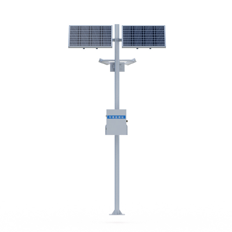
Visibility monitoring station is used to monitor the visibility of road environment and is suitable for road traffic applications on highways and bridges.The NJD50 Visibility monitoring station consists of several Visibility monitoring stations distributed along the expressway.It automatically monitors the visibility, current weather phenomena, etc.along the expressway, and promptly transmits the monitoring information to the monitoring for reference for the traffic control system.It can issue warning information in a timely manner under harsh weather conditions, and informs managers and drivers in various ways to improve the driving level of the expressway.In addition, it can also be added at any time according to the actual needs of users: temperature, humidity, wind, pressure and rain integrated meteorological stations, laser remote sensing road condition detectors, etc.to achieve multi-factor meteorological observation.
Visibility monitoring station system composition: visibility sensor, collector, pole bracket, power supply system, cloud platform
2.Visibility monitoring station product features
1.Visibility meter: consists of main components such as light emitter, light receiver and microprocessor controller.The transmitter emits infrared pulsed light, and the receiver simultaneously detects the pulse light intensity of forward scattered aerosol particles in the atmosphere.All measurement information is collected by the microprocessor controller and converted into meteorological optical range through a special mathematical model algorithm.
2.Standard GPRS wireless transmission
3.Free choice of two power supply methods: solar power supply and mains power supply
3.Visibility monitoring station technical parameters
Visibility: Principle of measurement aerosol pre-scattering, 0-50km (≤2km ±2%2km~10km ±5%>10km ±10%) resolution 1m
| Main parameters | Parameter range | Resolution | error |
| Range | 50km | 1m | ≤2km ±2%2km~10km ±5%>10km ±10% |
| Repeatability | ≤4% | ||
| Weather phenomena | Fog, rain, snow, mixed precipitation, sunny | ||
| Weather phenomenon recognition rate | ≥95% | ||
| Operating temperature | -40~60℃ | ||
| Working humidity | 0~100%RH | ||
| Working power supply | 12~24V | ||
| Power consumption | 1W | ||
| size | 610x230x360mm (Length x Width x Height) | ||
| weight | ≤10kg | ||
4.Introduction to the Visibility monitoring station cloud platform
1.CS architecture software platform, supports direct observation of mobile phones and PC browsers without additional software installation.
2.Support multiple accounts and multiple devices to log in
3.Support real-time data display and historical data display dashboard
4.Cloud server and cloud data storage are stable and reliable, easy to expand, and load balancing.
5.Support SMS alarm and threshold settings
6.Support map display and viewing device information.
7.Support data curve analysis
8.Support data export table form
9.Supports data forwarding, HJ-212 protocol, TCP forwarding, http protocol, etc.
10.Support data post-processing function
11.Support external running of javascript scripts
In today's society, with the acceleration of the processes of industrialization and urbanization, air quality issues have received increasing attention from people. There is a wide variety of pollutants in the air. Among them, the "four gases" (carbon monoxide, sulfur dioxide, nitrogen...
The Series power supply supporting UAV inspection is a special supporting equipment for UAV inspection of photovoltaic power plants, also known as Series power supply or UAV string power supply. Its core function is to convert alternating current into direct current and input it into the battery pan...
Negative oxygen ion powder is a special material added to spray paints, mainly composed of natural mineral powders such as tourmaline powder. Tourmaline has pyroelectric and piezoelectric properties: when subjected to temperature or pressure changes, an electric potential difference is generated bet...
Smart weather station is a highly integrated, low-power, and rapidly deployable automatic meteorological observation device. It can perform real-time and precise monitoring of wind speed, wind direction, temperature, humidity, atmospheric pressure, PM2.5, PM10, and noise, and features IoT clou...


 Get a Free Quote
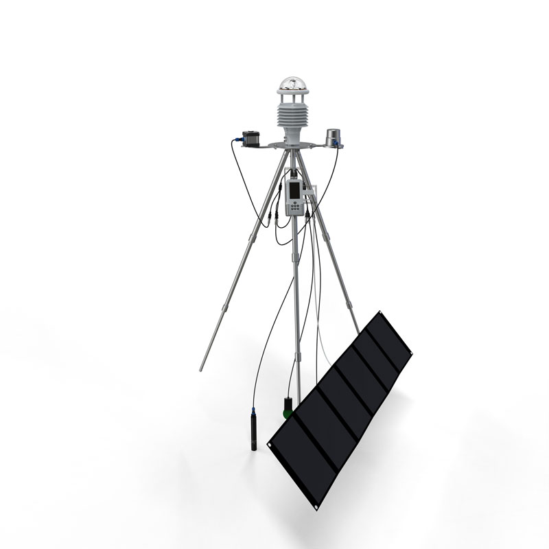
 Skype
Skype
 whatsapp
 mail
mail