Tianyi Sensor IOT Technology Co., Ltd
Sales Manager:Ms. Emily Wang
Cel,Whatsapp,Wechat:+86 15898932201
Email:info@fengtutec.com
Add:No. 155 Optoelectronic Industry Accelerator, Gaoxin District, Weifang, Shandong, China


Sales Manager:Ms. Emily Wang
Cel,Whatsapp,Wechat:+86 15898932201
Email:info@fengtutec.com
Add:No. 155 Optoelectronic Industry Accelerator, Gaoxin District, Weifang, Shandong, China
time:2025-07-03 08:55:42 source:Weather Station viewed:409 time
Against the backdrop of climate change, extreme rainfall events are becoming increasingly frequent, posing severe challenges to flood control and drought relief work. As an important technical means to address these challenges, the rainfall monitoring station is playing an increasingly significant role.
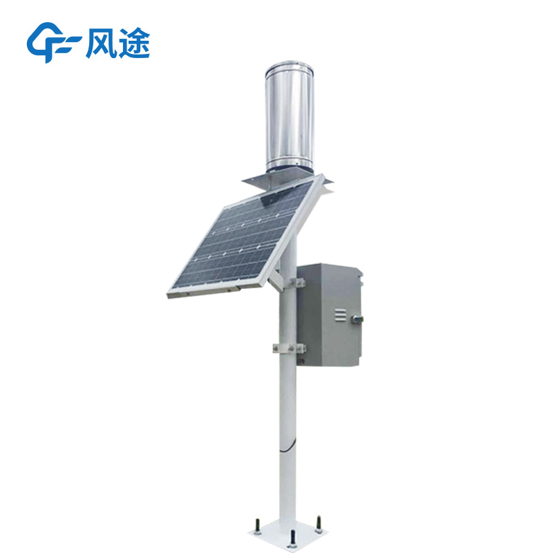
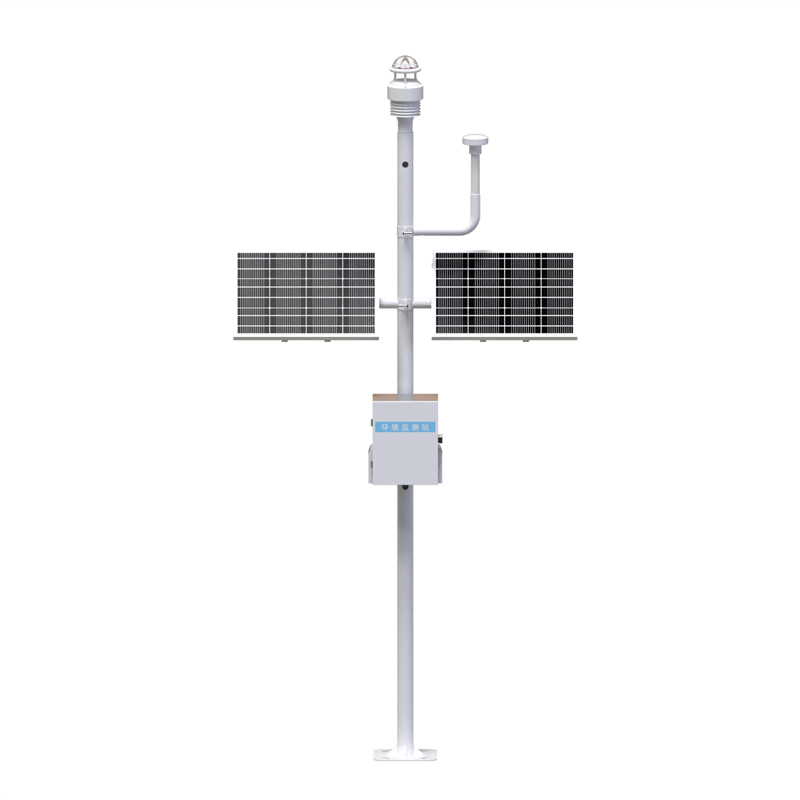
A rainfall monitoring station consists of a rainfall sensor, a data collector, a transmission module, and a cloud platform. Rainfall sensors can adopt tipping bucket, piezoelectric, or optical types, etc., which can accurately measure rainfall in millimeters or even 0.01-millimeter levels, with a resolution up to the minute level. The data collector collects data from the sensor, performs preliminary processing and storage, and has functions such as real-time clock and timing storage to ensure the accuracy and integrity of the data. The transmission module transmits the data to the cloud platform quickly through wireless communication technologies such as 4G, 5G, and LoRa. The cloud platform conducts in-depth analysis and storage of the data and provides visual display.
The working principle of the system is not complicated. When it rains, the rainfall sensor detects raindrops and converts them into electrical signals. For example, in a tipping bucket rain gauge, when the rainfall reaches a preset value, the bucket tips to trigger a switch, outputting a pulse signal to achieve digital recording of rainfall. The data collector collects these signals regularly, and after preliminary processing, sends them to the cloud through the transmission module. The cloud platform receives the data and stores it in a database. It can also generate rainfall maps and predict watershed peak flood flows by combining traditional hydrological models, providing a data foundation for subsequent applications.
In flood control, it can monitor changes in rainfall in real time and provide key data for flood warnings. For example, by deploying a large number of monitoring nodes in a watershed, and through data feedback at short time intervals, many mountain flood disasters have been successfully warned, gaining precious time for resident evacuation. When integrated with water level stations, by fusing rainfall intensity and river water level data, flood risks can be warned several hours in advance. For urban waterlogging, by deploying monitoring stations at key nodes of the drainage network and integrating with pipe network liquid level sensors to build a flood risk heat map, the intelligent water affairs platform can be coordinated to automatically trigger the start and stop of pumping stations, effectively reducing waterlogging points. In drought relief, the precipitation data accumulated by the system can help farmers dynamically adjust irrigation strategies based on crop water demand models, achieve precise irrigation, and save water resources.
Visual rainfall monitoring is an advantage of the system. Through the data visualization platform, users can intuitively see the change curve of rainfall over time, regional precipitation heat maps, etc. Complex rainfall monitoring data are presented in a graphical interface. Management departments can clearly grasp the rainfall situation based on this and formulate scientific and reasonable decisions, such as adjusting urban drainage plans and issuing warning information. In addition, the system also supports multi-parameter display, integrating meteorological parameters such as temperature, humidity, and wind speed with rainfall data for display, building a multi-dimensional monitoring network to enhance the overall grasp of weather conditions.
Underwater sonar imaging sounder is a portable underwater detection device integrating sonar technology and video recording. It generates high-resolution underwater topographic images, 3D models, and target location information by emitting sound waves into the water and receiving the echoes. It is suitable for single-person outdoor operations such as underwater search and rescue, topographic mapping, and engineering surveys....
In winter, there is frequent rain and snow, and road icing seriously affects the safety of pedestrians and vehicles. To address this issue, our company has launched the Road Ice Sensor. By adopting microwave electrical signal detection technology and equipped with a temperature compensation function...
Scenic areas pay particular attention to negative oxygen ions because the concentration of negative oxygen ions is an important indicator for measuring the quality of air and the ecological environment. Negative oxygen ions have the functions of purifying the air, improving cardiopulmonary function,...
Underwater Side-Scan Sonar utilizes the underwater propagation characteristics of sound waves to perform underwater detection through electro-acoustic conversion and information processing. Equipped with a 7-inch high-brightness IPS screen, it supports independent control of four- or six-way s...


 Skype
Skype
 whatsapp
 mail
mail