Tianyi Sensor IOT Technology Co., Ltd
Sales Manager:Ms. Emily Wang
Cel,Whatsapp,Wechat:+86 15898932201
Email:info@fengtutec.com
Add:No. 155 Optoelectronic Industry Accelerator, Gaoxin District, Weifang, Shandong, China

Sales Manager:Ms. Emily Wang
Cel,Whatsapp,Wechat:+86 15898932201
Email:info@fengtutec.com
Add:No. 155 Optoelectronic Industry Accelerator, Gaoxin District, Weifang, Shandong, China
time:2025-07-11 08:49:34 source:Weather Station viewed:199 time
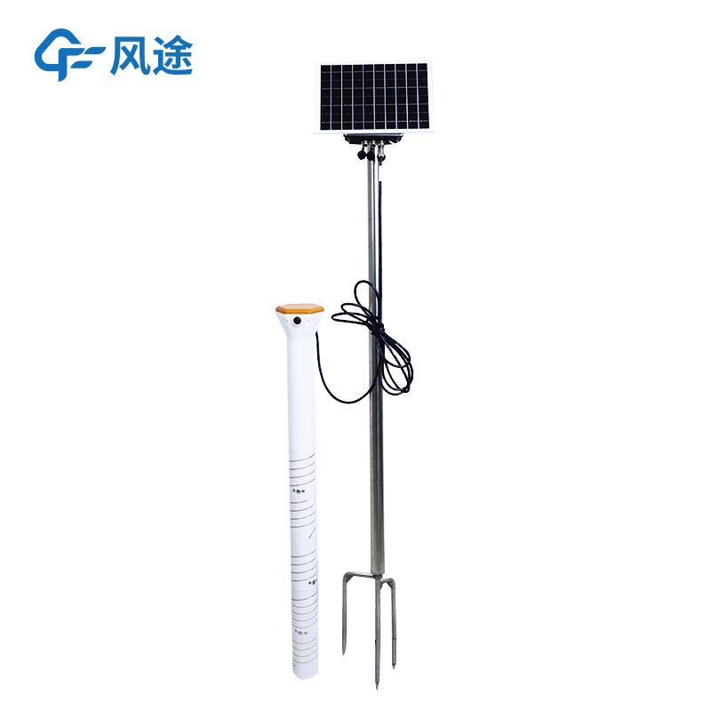
In the development process of smart agriculture, various advanced technologies and equipment are continuously updating agricultural production modes. As a core tool, the soil moisture monitoring station is deeply integrating into the modern agricultural production system.
Soil moisture, i.e., the soil humidity condition, directly affects every link in the growth cycle of crops. Appropriate humidity can ensure seed germination, root development, and nutrient absorption, which is the basis for high and stable yields. Traditional monitoring relies on manual sampling and measurement, which not only has a limited coverage range and poor data timeliness but also requires a lot of labor costs, making it difficult to meet the management needs of large-scale agriculture.
The soil moisture monitoring station achieves precise monitoring by integrating multiple sensing technologies. The soil moisture sensor equipped in the device adopts the principle of frequency domain reflection. It emits electromagnetic signals of specific frequencies and directly outputs data on the volume water content of the soil based on the correlation between the soil dielectric constant and water content, with a measurement accuracy of ±2%. The supporting temperature sensor (measuring range from -30℃ to 70℃) and conductivity sensor (measuring range from 0 to 20000μS/cm) simultaneously record the soil temperature and heat conditions as well as salt content, forming a multi-dimensional soil environment data matrix.
The device uploads the real-time collected data to the management platform through wired or wireless transmission modules. Farmers can check the moisture dynamics of the monitoring points at any time through computer clients or mobile terminals, including hourly change curves and historical data comparisons. The system is equipped with a manual threshold adjustment function. When the soil moisture is lower than the critical value of crops (for example, wheat needs to maintain 60%-70% of field capacity during the jointing stage) or higher than the waterlogging critical value, it will send prompts via SMS or platform push to guide farmers in carrying out precise irrigation or drainage operations.
The application value of this device is even greater in large-scale planting scenarios. In field crop planting, a multi-point monitoring network combined with GPS positioning can draw a distribution map of field moisture, realizing zoned irrigation and increasing water resource utilization by more than 30%. By linking moisture data with the irrigation system, the frequency and duration of drip irrigation can be automatically controlled, reducing the waste of water and fertilizer caused by deviations in human judgment.

A Portable Weather Station is a device that can be carried around and automatically complete meteorological data collection, mainly used for meteorological monitoring in field, emergency and other scenarios. It integrates the core functions of traditional weather stations in a compact structure, and...
Please note that this is a basic meteorological instrument capable of monitoring only wind speed, wind direction, air temperature and humidity, and air pressure.When equipped with sensors for dust concentration, harmful gases (such as sulfur dioxide, nitrogen oxides), PM2.5, PM10, etc., it becomes a...
An air quality monitoring station is an unmanned environmental monitoring device that integrates data collection, storage, transmission, and management. Its core advantage lies in its ability to conduct high-precision, real-time monitoring of various pollutants. The system can provide data on parame...
The Wind Sensor employs the time-of-flight measurement principle, accurately calculating wind speed and direction by detecting changes in the speed of ultrasonic waves propagating in the air....