Tianyi Sensor IOT Technology Co., Ltd
Sales Manager:Ms. Emily Wang
Cel,Whatsapp,Wechat:+86 15898932201
Email:info@fengtutec.com
Add:No. 155 Optoelectronic Industry Accelerator, Gaoxin District, Weifang, Shandong, China


Sales Manager:Ms. Emily Wang
Cel,Whatsapp,Wechat:+86 15898932201
Email:info@fengtutec.com
Add:No. 155 Optoelectronic Industry Accelerator, Gaoxin District, Weifang, Shandong, China
time:2025-07-23 08:50:12 source:Weather Station viewed:372 time
The water and rainwater detection equipment, namely the Water Level Monitoring System, can efficiently and accurately obtain data such as water level, flow rate, and rainfall.
The Water Level Monitoring System is a fully automatic hydrological online monitoring system based on microwave technology. In terms of water level measurement, it is realized by transmitting and receiving radar beams. The transmitter in the equipment emits radar beams to the water surface, and after the beams hit the water surface, they are reflected back and received by the receiver. Since the propagation speed of radar beams in the air is a known constant, the distance from the radar antenna to the water surface can be calculated according to the round-trip time of the beams. Moreover, because the installation height of the monitoring station is fixed and known, the accurate water level height can be obtained by subtracting the measured distance from the installation height. This non-contact measurement method avoids the problem that traditional contact measurement is interfered by factors such as water quality, sediment, and floating objects.
The measurement of flow rate is relatively more complex. The formula for calculating flow rate is: Flow Rate = Average Flow Velocity × Cross - sectional Area of Flow × Correction Coefficient. To obtain the average flow velocity, the surface velocity of the fluid is collected by a current meter, and then it is calculated through a model. The cross - sectional area of flow is calculated from the water level measured by the water level gauge and the pre - known cross - section information. The monitoring station can calculate and output the real - time cross - sectional flow and cumulative flow by using the built - in software algorithm and combining the measured flow velocity and water level data. Through the accurate monitoring of flow rate, we can reasonably dispatch water resources and assess flood risks.
Rainfall monitoring is also an important function of the Water Level Monitoring System. It uses a tipping bucket rain gauge. When it rains, the rainwater enters the tipping bucket through the rain receiver. When the amount of rainwater received by the tipping bucket reaches a certain level, it will automatically tip over under the action of gravity to pour out the rainwater. During the tipping process of the tipping bucket, it will trigger the reed switch to generate a switch signal. The monitoring station can calculate the cumulative rainfall and rainfall intensity by recording the number of signals generated by the reed switch and combining it with the measurement accuracy of the tipping bucket (i.e., the rainfall value represented by each tip). This measurement method has a simple structure and stable performance, and can measure rainfall relatively accurately, providing reliable rainfall data for meteorological analysis, flood control, and drought relief work.
At present, the Water Level Monitoring System is widely used in scenarios such as rivers, lakes, reservoir gates, underground water pipe networks, and irrigation canals, assisting in water treatment operations such as urban water supply and sewage monitoring.
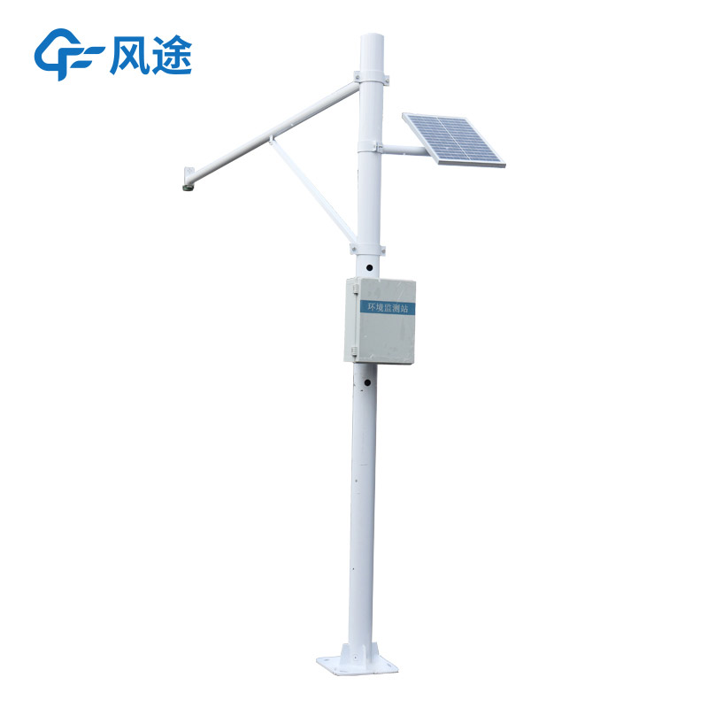
The operation of air quality monitoring stations relies on a comprehensive grid-based environmental supervision system. This system takes towns, communities (and villages) in cities as basic units, and divides them into air pollution prevention and control management grids according to different lev...
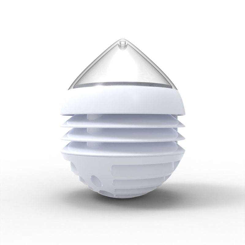
A weather phenomenon sensor is an optical measuring instrument that uses the forward scattering principle. It emits an infrared pulse beam into the atmosphere and receives the scattering signals from aerosol particles, calculating the extinction coefficient to determine the visibility value. T...
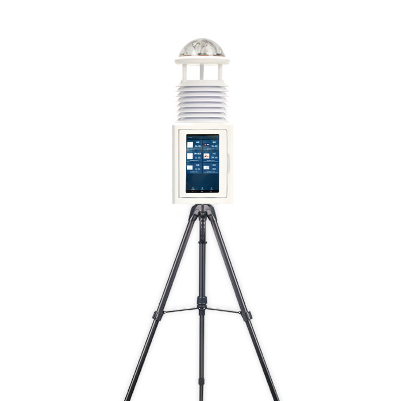
As a convenient and efficient meteorological monitoring device, the performance improvement of the Portable Weather Station is closely related to the application of new ultrasonic sensors.The Portable Weather Station features small size, portability, easy installation and operation, enabling meteoro...
In the daily operation and maintenance of photovoltaic power plants, testing equipment is a key tool to ensure power generation efficiency and system stability. Among them, the EL detector and I-V Curve Tracer are two widely used professional devices that evaluate the performance of photovoltaic mod...


 Skype
Skype
 whatsapp
 mail
mail