Tianyi Sensor IOT Technology Co., Ltd
Sales Manager:Ms. Emily Wang
Cel,Whatsapp,Wechat:+86 15898932201
Email:info@fengtutec.com
Add:No. 155 Optoelectronic Industry Accelerator, Gaoxin District, Weifang, Shandong, China


Sales Manager:Ms. Emily Wang
Cel,Whatsapp,Wechat:+86 15898932201
Email:info@fengtutec.com
Add:No. 155 Optoelectronic Industry Accelerator, Gaoxin District, Weifang, Shandong, China
time:2026-10-29 10:48:18 source:Weather Station viewed:1 time
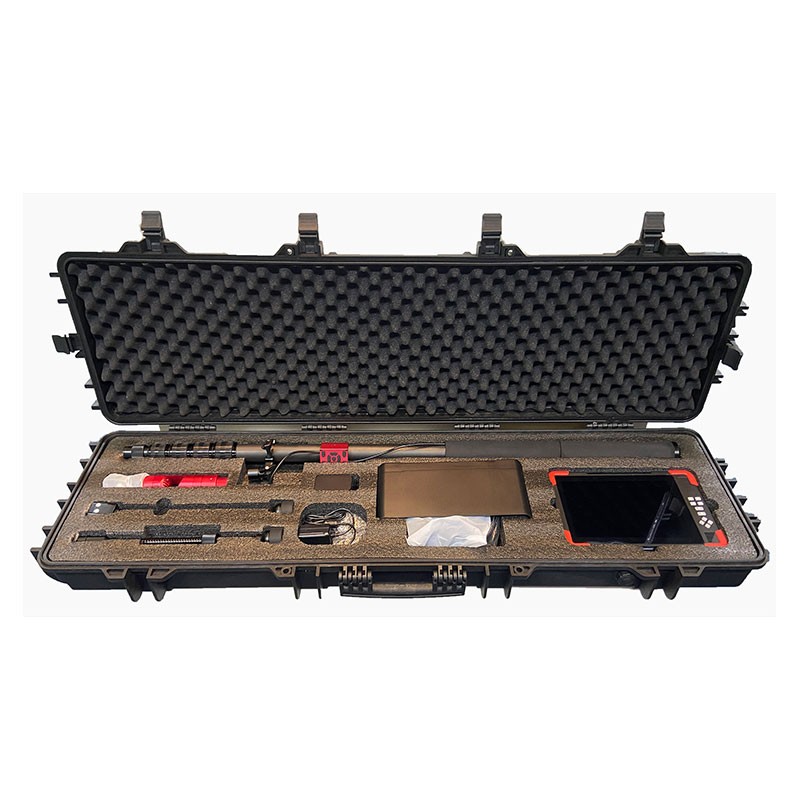
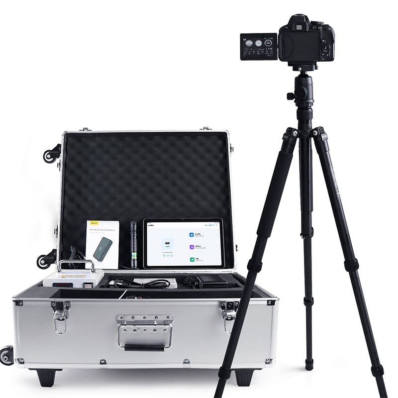
Geological disaster emergency rescue equipment is equipped with a motorized audio-visual camera probe designed to access narrow spaces, such as collapsed buildings or caved-in shafts. It captures high-definition video and two-way audio from within the debris. The system includes a large-screen control unit that supports image magnification, storage, and rotation, making it well-suited for search and rescue operations at the sites of geological disasters.
Geological disaster emergency rescue equipment is primarily used to locate individuals trapped in scenarios such as roadbed landslides, foundation subsidence, underground shaft collapses, or building structural failures. The device features a 10-inch full-color display, with a compact overall form factor of no more than 300 × 190 × 20 mm. Including the battery, the unit weighs less than 1 kg and is designed for one-handed operation. It comes with a sunshade to minimize glare, and the intuitive button layout ensures that operators can quickly master its use. The control unit supports photo and video capture, with a 256 GB SD card for data storage. It offers 8x digital zoom and allows for multi-directional image rotation (up, down, left, and right). Additionally, it includes a built-in location-tagging feature, enabling users to embed positional data directly into photos—facilitating subsequent documentation archiving and on-site verification of specific locations.
Geological disaster emergency rescue equipment utilizes a 1080P high-definition motorized probe with a diameter of less than 40 mm. The probe supports continuous 360-degree rotation and 270-degree tilting. It is equipped with 12 integrated white-light LEDs to provide illumination in dark, rubble-filled environments. A two-way intercom function establishes a communication channel between search and rescue personnel and those trapped. The device is powered by a rechargeable battery, offering at least eight hours of continuous operation to support prolonged, uninterrupted search and rescue missions. Geological disaster emergency rescue equipment is well-suited for procurement projects under initiatives such as the "Natural Disaster Emergency Response Capability Enhancement Project" for fire and rescue corps and the "Emergency Response Capability Enhancement Project" for emergency management bureaus. In complex geological disaster scenarios—such as landslides, road collapses, or tunnel cave-ins—it overcomes the limitation that prevents personnel from entering confined spaces within debris. By providing a stable, real-time feed of audio and visual data from the site, it assists rescue teams in assessing the condition of trapped individuals and formulating effective rescue strategies, thereby enhancing both the safety and efficiency of search and rescue operations in the wake of geological disasters.
By measuring the total atmospheric extinction coefficient via the forward-scattering principle, the instrument calculates visibility values. It offers a measurement range of up to 10 km with a resolution of 1 m, and its measurement accuracy complies with established classification standards. It is s...
Underwater sonar imaging sounder is a portable underwater detection device integrating sonar technology and video recording. It generates high-resolution underwater topographic images, 3D models, and target location information by emitting sound waves into the water and receiving the echoes. It is suitable for single-person outdoor operations such as underwater search and rescue, topographic mapping, and engineering surveys....
Traditional flow measurement involves trekking through mountains and rivers, enduring sun and rain, while modern technology can achieve fully automatic monitoring with just one device.River flow measurement is a crucial part of water conservancy work, directly related to flood control, drought relie...
When it comes to anemometers, the most classic Mechanical anemometer immediately comes to mind. It realizes the measurement of wind speed and direction through mechanical structures and physical principles, and its classic nature stems from a mature technical system and extensive application practic...


 Skype
 whatsapp
 mail