Tianyi Sensor IOT Technology Co., Ltd
Sales Manager:Ms. Emily Wang
Cel,Whatsapp,Wechat:+86 15898932201
Email:info@fengtutec.com
Add:No. 155 Optoelectronic Industry Accelerator, Gaoxin District, Weifang, Shandong, China


Sales Manager:Ms. Emily Wang
Cel,Whatsapp,Wechat:+86 15898932201
Email:info@fengtutec.com
Add:No. 155 Optoelectronic Industry Accelerator, Gaoxin District, Weifang, Shandong, China
time:2025-06-12 08:51:46 source:Weather Station viewed:502 time
Microwaves refer to electromagnetic waves with frequencies ranging from 300MHz to 300GHz and wavelengths from 1 millimeter to 1 meter. Due to their high frequency and short wavelength, they have strong directivity and penetrating power, enabling stable propagation under different meteorological conditions. This provides a reliable signal foundation for water level measurement.
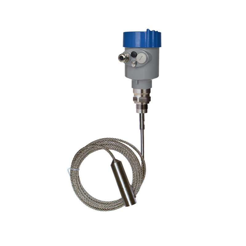
Back to the topic, the Radar water level sensor operates based on the principle of electromagnetic wave ranging. The device is installed above the water level monitoring point and emits microwave signals toward the water surface. After the signals contact the water surface, they are reflected back to the radar device. The built-in receiver of the radar captures the reflected signals, calculates the time difference between the transmitted and received signals, and combines the propagation speed of microwaves in the air (approximating the speed of light). Using the formula "distance = propagation speed × time difference / 2", the vertical distance between the device and the water surface can be accurately obtained. By subtracting this distance from the preset installation height of the device, real-time water level data is obtained.
In the water level measurement of natural water areas such as rivers, shoals, and lakes, the Radar water level sensor has obvious advantages compared with other water level gauges. First, it adopts a non-contact measurement method, which does not need to directly contact the water body, is not affected by factors such as water body corrosion, icing, and floating objects, and has a long service life and low maintenance cost. Second, it has high measurement accuracy, with an error controllable within the millimeter level, and can monitor water level changes in real time and continuously. Third, the device has strong environmental adaptability and can adapt to severe weather such as rainstorms and heavy fog, as well as nighttime environments, making it widely applicable to various complex water area scenarios. Finally, the Radar water level sensor supports remote data transmission, and the measurement data can be real-time uploaded to the monitoring center through a wireless communication network, which is convenient for managers to timely grasp the water level dynamics and provide a scientific basis for decision-making such as flood control, drought resistance, and water resource scheduling.
This chapter only introduces the core knowledge of the Radar water level sensor. If you also want to understand its technical parameters, application cases, and prices, please consult our customer service.

Life Detector Device integrates infrared thermal imaging detection, 4K high-definition video observation, and two-way voice communication functions. This device can effectively locate signs of life in complex environments such as debris and enable communication between rescuers and those trapp...
The Wind Sensor employs the time-of-flight measurement principle, accurately calculating wind speed and direction by detecting changes in the speed of ultrasonic waves propagating in the air....
Meteorological monitoring system is a high-precision automatic meteorological observation device integrating temperature, humidity, wind speed, wind direction, and atmospheric pressure sensors. This device combines ultrasonic detection technology to achieve accurate all-weather monitoring of meteorological elements....
The rain and water conditions refer to the changes in hydrological elements such as rainfall, river and reservoir water levels, and flow rates within a region. They serve as important bases for flood control and disaster reduction as well as water resource management. Measuring the rain and water co...


 Skype
 whatsapp
 mail