Tianyi Sensor IOT Technology Co., Ltd
Sales Manager:Ms. Emily Wang
Cel,Whatsapp,Wechat:+86 15898932201
Email:info@fengtutec.com
Add:No. 155 Optoelectronic Industry Accelerator, Gaoxin District, Weifang, Shandong, China


Sales Manager:Ms. Emily Wang
Cel,Whatsapp,Wechat:+86 15898932201
Email:info@fengtutec.com
Add:No. 155 Optoelectronic Industry Accelerator, Gaoxin District, Weifang, Shandong, China

Model:FT-BQX12
Brand:tianyi
1.Introduction to Meteorological Stations
Meteorological Stations is a meteorological product suitable for personal or professional use that can take anyone's weather expertise to the next level.BQX12 Meteorological Stations is a highly integrated, low-power, fast installation and easy for field monitoring.
The device supports wired, Bluetooth, GPRS and other transmission methods, is debug-free and can be quickly arranged.It is suitable for the acquisition of meteorological data such as short-term emergency meteorological observations and mobile meteorological monitoring.It is widely used in meteorology, agriculture and forestry, environmental protection, ocean, airport, port, scientific investigation, campus education and other fields.
The device adopts a twelve-element integrated sensor, which can conduct real-time observation of weather elements such as wind speed, wind direction, air temperature, humidity, atmospheric pressure, optical rainfall, PM2.5, PM10, CO, SO2, NO2, O3, etc.The sensor shell is made of imported Stainless steel material, which is more effective in resisting salt spray and other environments, and the protection level reaches IP65 or above.
2.Meteorological Stations product features
1.The hidden ultrasonic probe on the roof cover can avoid interference from rain and snow accumulation, and avoid natural wind shading☆
2.The principle is to transmit a continuous frequency conversion ultrasonic signal, and to detect the wind speed and direction by measuring the relative phase☆
3.Wind speed, wind direction, air temperature, humidity, atmospheric pressure, optical rainfall, PM2.5, PM10, CO, SO2, NO2, O3 twelve elements integrated sensor☆
4.Standard configuration: GPRS, Bluetooth, 485 to USB
5.Aluminum alloy bracket, retractable
6.Shock-absorbing protective trolley case, easy to carry
3.Meteorological Stations technical parameters
1.Wind speed: measurement principle: ultrasonic wave, range: 0~60m/s, accuracy: 0.1m/s+0.01v, resolution: 0.1m/s;
2.Wind direction: measurement principle: ultrasonic wave, range: 0~360°, accuracy: ±2°, resolution: 1°;
3.Air temperature: measurement principle diode junction voltage method, range: -40-80℃, accuracy: ±0.3℃ (25℃), resolution: 0.01℃;
4.Air humidity: measurement principle capacitive type, range: 0-100%RH, accuracy: ±3%RH (20%~80%), resolution: 0.01%RH;
5.Atmospheric pressure: measurement principle piezoresistive type, range: 300-1100hpa, accuracy: ±0.25%, resolution: 0.1hpa;
6.PM2.5: Range: 0-1000ug/m3, accuracy: ±10% (<500 micrograms), resolution: 1ug/m3;
7.PM10: Range: 0-1000ug/m3, accuracy: ±10% (<500 micrograms), resolution: 1ug/m3;
8.Optical rainfall: range: 0-4mm/min, accuracy: ≤±4%, resolution: 0.01mm;
9.Carbon monoxide: range: 0-1000ppm, accuracy: ±2PPM, resolution: 1PPM;
10.Sulfur dioxide: Range: 0-20ppm, Accuracy: ±1PPM, Resolution: 0.1PPM;
11.Nitrogen dioxide: Range: 0-20ppm, Accuracy: ±1PPM, Resolution: 0.1PPM;
12.Ozone: 0-20ppm, Accuracy: ±1PPM, Resolution: 0.1PPM;
13.Data storage: no less than 500,000 pieces;
14.Power consumption: 1.5W
15.Lithium battery: capacity 12000maH, battery life ≥50h, battery capacity display function
16.Total weight of equipment: ≤5kg;
17.Layout time: 1 person, no more than 2 minutes to complete the layout;
18.The manufacturer has ISO quality management system, environmental management system and occupational health management system certification
19.The manufacturer has a computer software registration certificate
20.The manufacturer is a 3A credit enterprise
4.Introduction to Meteorological Stations computer software
1.Software for receiving, storing, viewing and analyzing PC stand-alone version of data
2.Support serial port data reception, processing and display
3.Support json strings, modbus485 and other communication methods
4.The storage time can be set by itself.The acquisition time can be set by itself in modbus485 acquisition mode
5.Support self-service addition, deletion, and modification of monitoring parameters protocols, names, icons, etc.
6.Support data post-processing function
7.Support external running of javascript scripts
5.Introduction to Meteorological Stations Android APP
1.Android stand-alone version of data reception, storage, viewing and analysis software
2.Support Bluetooth data reception
3.The software background reception and processing after the mobile phone is dormant
4.Json data is automatically added to the device, modbus device supports scanning code to add the device
5.Support historical data viewing, analysis, and export tables, support curve display and single data point viewing
6.Support data post-processing function
7.Support external running of javascript scripts
6.Introduction to Meteorological Stations cloud platform
1.CS architecture software platform, supports direct observation of mobile phones and PC browsers without additional software installation
2.Support multiple accounts and multiple devices to log in
3.Support real-time data display and historical data display dashboard
4.Cloud server and cloud data storage, stable and reliable, easy to scale, and load balanced
5.Support SMS alarm and threshold settings
6.Support map display and viewing device information
7.Support data curve analysis
8.Support data export table form
9.Support data forwarding, HJ-212 protocol, TCP forwarding, http protocol, etc.
10.Support data post-processing function
11.Support external running of javascript scripts
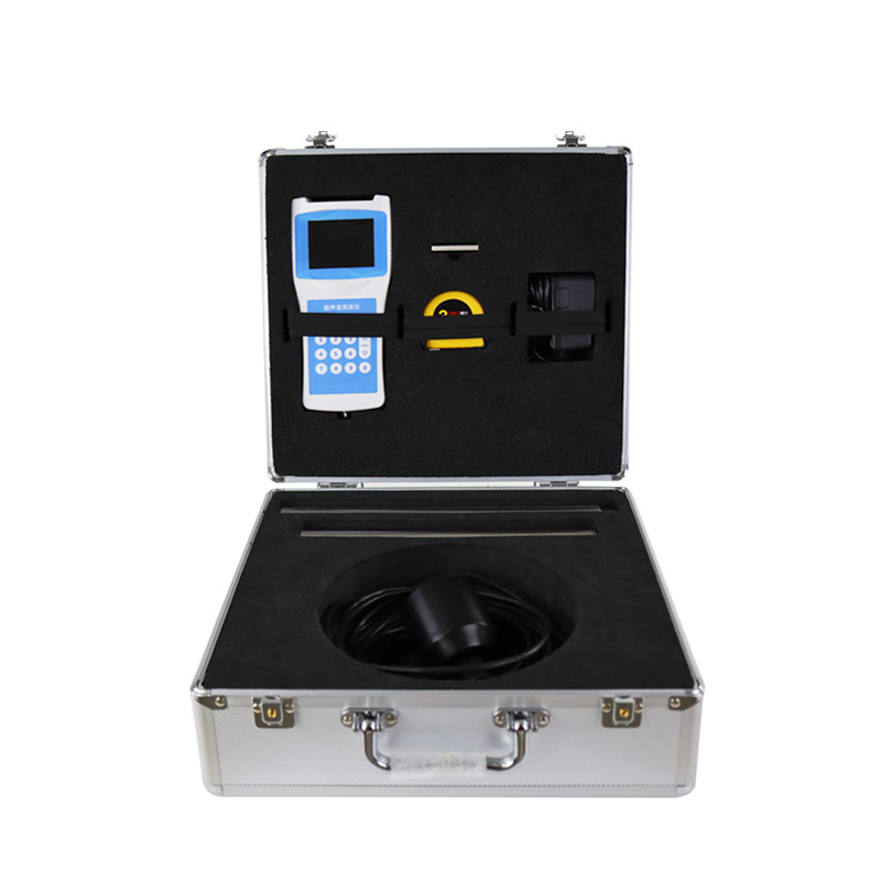
Recommend Several Excellent Water Quality MonitorsI. Portable Multi-parameter Detector (FT-SS07)It covers all parameters and supports the detection of 12 parameters such as water temperature, conductivity, pH, ammonia nitrogen, dissolved oxygen, COD, turbidity, etc. It adopts all-digital elect...
Methane, as the main component of natural gas, is widely used in industrial production and urban gas supply. However, its colorless, odorless, flammable and explosive properties make methane leakage a major safety hazard. The handheld Laser methane telemeteris mainly used for long-distance mea...
As the impacts of climate change continue to intensify, the frequency and destructive scale of flood disasters are on the rise, posing severe threats to public safety and socio-economic development. Summer is inherently a high-risk period for disasters such as floods and droughts. To further enhance...
Visibility and Present Weather Sensor uses the forward scattering method to measure the total extinction coefficient of air, with a range of up to 30 kilometers. It is widely used in road traffic, meteorology, and other industries. The instrument features weather phenomenon recognition, low po...


 Get a Free Quote
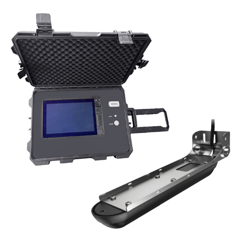
 Skype
Skype
 whatsapp
 mail
mail