Tianyi Sensor IOT Technology Co., Ltd
Sales Manager:Ms. Emily Wang
Cel,Whatsapp,Wechat:+86 15898932201
Email:info@fengtutec.com
Add:No. 155 Optoelectronic Industry Accelerator, Gaoxin District, Weifang, Shandong, China


Sales Manager:Ms. Emily Wang
Cel,Whatsapp,Wechat:+86 15898932201
Email:info@fengtutec.com
Add:No. 155 Optoelectronic Industry Accelerator, Gaoxin District, Weifang, Shandong, China
Model:FT-YC05
Brand:tianyi
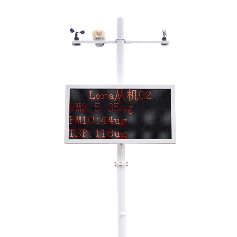
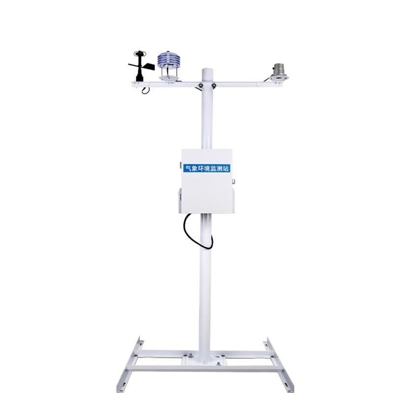
PM2.5 Air Quality Monitor measures real-time PM2.5 concentrations for residential, commercial or industrial use and can be installed indoors or outdoors.In order to improve air quality, our company uses wireless sensor technology and laser dust testing equipment, and PM2.5 Air Quality Monitor independently developed , in addition to achieving dust monitoring, can also monitor environmental factors such as PM2.5, PM10, PM1.0, TSP, noise, ambient temperature, environmental humidity, wind speed, wind direction, etc.The test data of each test point is directly uploaded to the monitoring backend through wireless communication, greatly saving the monitoring costs of the environmental protection department and improving monitoring efficiency.
PM2.5 Air Quality Monitor Application Industry:
It is mainly suitable for construction sites, demolition sites, coal mines, industrial parks, communities, urban environments, residential communities, etc.
PM2.5 Air Quality Monitor Technical Parameters:
1.PM range: 0~1000ug/m3, resolution: 1ug/m3, accuracy: ±10%F·S;
Air temperature sensor range: -40~70℃, resolution: 0.1℃, accuracy: ±0.2℃;
Air humidity sensor range: 0~100%, resolution: 0.1%, accuracy: ±3%;
Wind speed sensor range: 0~60m/s, resolution: 0.1m/s Accuracy: ±0.3m/s;
Wind direction sensor range: 8 azimuth;
Noise sensor range: 30~130db, resolution: 0.1db Accuracy: ± 0.5% F·S
2.The Pm measurement adopts the principle of laser scattering, uses a fan as the power, and has a built-in insect-proof net, so that data measurement will not be inaccurate due to small insects.
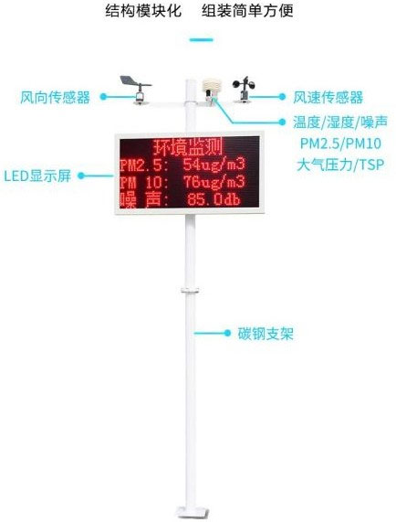
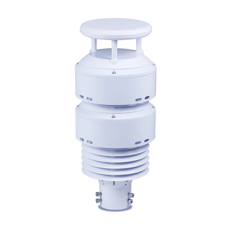
3.The equipment has 1-channel louver box (temperature, humidity, noise, PM2.5, PM10, air pressure) collection, 1-channel wind speed collection, and 1-channel wind direction collection.
4.Supports secondary development, including networking modules, default GPRS upload, and can connect to government project platforms in various regions for free (4G upload method can be changed), and defaults to 1 standard modbus output.
5.The default is to have one relay output, and the Pm2.5 exceeds the limit and can automatically associate the fog cannon for on-site dust reduction control;
6.The LED screen display header can be changed at any time and anywhere, and the header can be changed through the configuration APP and software side;
7.The LED large screen size is 54cm*102cm, and can be displayed in three lines or four lines and can be changed at will;
8.Optional on-site sound and lightning alarm, waterproof tank, lightning arrester
9.Simple and convenient installation, fool-style installation
Underwater Side-Scan Sonar utilizes the underwater propagation characteristics of sound waves to perform underwater detection through electro-acoustic conversion and information processing. Equipped with a 7-inch high-brightness IPS screen, it supports independent control of four- or six-way s...
High-altitude migratory pests refer to a category of pests that rely on their own flight capabilities or high-altitude air currents to carry out long-distance and large-scale migrations during their growth and development. For example, the fall armyworm and the East Asian locust can fly at altitudes...
Traditional weather stations mostly use mechanical devices such as wind speed and direction indicators to measure meteorological elements. These devices have some limitations. For example, mechanical components are prone to wear and icing, requiring regular maintenance and calibration. Moreover, the...
Under the general trend of technology empowering agriculture, Agricultural meteorological stations are gradually becoming key facilities for ensuring agricultural production and promoting the modernization of agriculture.It can conduct real-time and precise monitoring of various meteorological...


 Get a Free Quote
 Skype
Skype
 whatsapp
 mail
mail